
BaumholderSmith Barracks, Baumholder


LEISURE TIME
Good to Know
GOOD TO KNOW
Regional activities
Looking for more events and recreational activities in the region? Visit the official website of the Rheinland-Pfalz Tourism Office to find out more about- Hiking
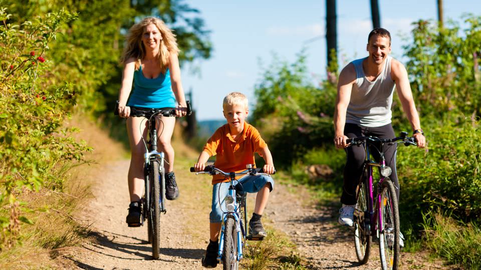
- Cycling
- Travel Highlights
- Event Highlights
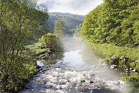
Baumholder Lake
Stadtweiher
Ringstraße
55774 Baumholder
Short Description
This 7 acres natural lake has good water quality and is open for swimming. Additionally there are beach volleyball courts and a large sandbox for the kids. In the wintertime (depending on weather conditions) the lake can be used for ice-skating.
Castle Lichtenberg
Burg Lichtenberg
Burgstraße 16
66871 Thallichtenberg
Short Description
Explore Germany´s largest castle ruins at castle Lichtenberg.
Opening hours
Every day: 10 a.m. - 5 p.m.
Contact information
Phone: 06381 8429
City Library
Stadtbücherei
Hauptstraße 15
55774 Baumholder
Opening hours
Tue.: 10 a.m. - 12 p.m.
Tue., Thu.: 4.30 - 6.30 p.m.
Sat.: 10 a.m. - 12 p.m.
Cycle Path - Castle Route
Radwege Baumholder
Frauenburg
55776 Frauenberg
Short Description
Baumholder and its surroundings offer two major bicycle paths marked with easy-to-follow logos. Due to the the rolling hills, cycling can be a little challenging. The paths are mostly country lanes with a solid surface. Some parts are low-traffic roads.
The Castle Route is a north-south path starting at the Frauenburg (castle) near Frauenberg and ends at Burg Lichtenberg (castle) in Thallichtenberg (in Kusel county).
Frauenburg (Frauenberg) - Kronweiler - Reichenbach - Heimbacherhof - Heimbach - Bächelshöfe - Fohren-Linden - Berschweiler - Thallichtenberg - Burg Lichtenberg.
The path is marked with the “Castle“ logo. With its rolling hills it has a difference in altitude of 925 meters.
From Thallichtenberg you can also connect with another path via Kusel to Altenglan and further down the Glan River; this is a rather flat route.
There is also a possibility to cycle from Frauenberg on the Naheradweg (Nahe cycle path) to Bingen on the Rhine River.
There is a bike and hiking map on the scale of 1: 25,000 available at the Verbandsgemeinde Baumholder (price: € 5,90).More information
Phone: 06783 810
Cycle Path - Lake Route
Radwege Baumholder
Badeweiher
55774 Baumholder
Short Description
Baumholder and its surroundings offer two major bicycle paths marked with easy-to-follow logos. Due to the the rolling hills, cycling can be a little challenging. The paths are mostly country lanes with a solid surface. Some parts are low-traffic roads.
The Lake Route is an east-west path that starts at the Baumholder Lakeand ends in Hahnweiler.
Stadtweiher Baumholder (Baumholder Lake) - Eschelbacherhof – Mettweiler - Berschweiler - Fohren-Linden - Bächelshöfe - Berglangenbach - Rückweiler - Hahnweiler .
The path is marked with the “Lake“ logo. The length is about 20 kilometers and with its rolling hills there is a difference in altitude of 580 meters.
The path can be followed to the Bostalsee (Bosen Lake) where you can also connect with the Naheradweg (Nahe bicycle path) that goes to Bingen on the Rhine River.
There is a bike and hiking map on the scale of 1: 25,000 available at the Verbandsgemeinde Baumholder (price: € 5,90).More information
Phone: 06783 810
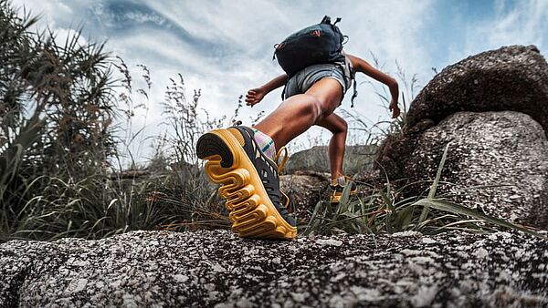
Hiking trail - Bärenbachpfad
Starting point
Am Weiherdamm 1
55774 Baumholder
Key data
Length: 14 km
Duration: approximately 3.5 hours
Ascent: 307 m
Descent: 317 m
Difficulty Level: Moderate
Short Description
Bärenbach Trail leads you through meadows and fields with unique long-distance views and through varied woodland with beautiful streams as well as mysterious places telling countless stories of the past.
The overlook of the Baumholder military training area is unique. On the one hand, the military training area has developed into a biotope and wildlife refuge but on the other hand it is still used for military purposes. The calm of the forest and the tranquility of nature invite you to stay and indulge in the beautiful experience at one of the numerous rest and barbecue areas (upon request) available along the way.
Hint: Take the train (RB 34) to Baumholder station. For further information visit Vlexx.
There are also designated rest spots along the trail to stop and have a barbecue.
Hiking trail - Gräfin Loretta
Starting point
Parking Lot for hikers at the shore of the Nahe River.
Bahnhofstraße 1
55776 Frauenberg
Key data
Length: 12.5 km
Duration: approximately 4 hours
Ascent: 398 m
Descent: 399 m
Difficulty Level: Moderate
Short Description
The Gräfin Loretta trail offers historic places, deep and calm creek valleys, enchanted sites and sublime views into the distance along the shores of the Nahe River.
Numerous rest and barbecue areas invite you to stay and indulge in the beautiful experience. Visit the premium hiking trail featuring history, nature and special details such as the “Kaiserallee”, the “Frauenburg” and the “Pfad der Trolle” for our little guests.
Hint: Upon request, tours of the castle as well as along the Dream Loop are available at any time.
Local Heritage Museum
Heimatmuseum
Hauptstraße 10
55774 Baumholder
Short description
The Local Heritage Museum displays fixtures and furnishings of the 19th century with documents and photos about the development of Baumholder and includes objects from the deserted villages of the military training area.
For example, one can see a presentation of the production of linen starting with flax up to the finished white linen in the closet. Beside it there is an interesting collection of stoves.
Opening hours
Every 2nd Sunday of the month: 2 - 5 p.m.
No entrance fee
Contact information
Phone: 06783 8116
Railroad Pedal Cars
Draisinentour
Am Bahnhof
66885 Altenglan
Short description
Beyond doubt, one of the most exciting activities the Glan-Valley has to offer: 40km of unused railroad track want to be discovered by you.
With the Draisine, a vehicle built for the tracks, you can experience the area first hand. While on the track, you can stop and get lunch in one of the restaurants or just enjoy the beautiful nature. You have to schedule your visit very early because the tour is often booked out months in advance. You can find more information on their website.
Contact information
Phone: 06381 424270
Rent the barbecue hut
Nöhringhütte
55774 Baumholder
Short Description
The town of Baumholder owns this BBQ area. The pavilion can be rented on a day-to-day basis.
For information call the City Office.Contact information
Phone: 06783 981140
Monday - Friday: 9 - 11 a.m.
Saar-Hunsrück-Climb
Saar-Hunsrück-Steig
The Saar-Hunsrück-Climb is a Premium long-distance trail, plus the 111 Saar-Hunsrück “Dream Loops” as Premium circular hiking trails.
Find more detailed information on the official website.
Sports Center
Sportzentrum Baumholder
Überm Weiher 7
55774 Baumholder
Short Description
The Sports Center of Baumholder is located between the School Center and the Baumholder Lake and provides a lot of opportunities for athletes to practice their sport activities.
At the “Brühlstadion,” there are two soccer fields; one of them is a grass turf and is mainly used for soccer and school athletics. The other one is an astroturf field that is often used for soccer tournaments. Both the sports grounds and the clubhouse are maintained and run by VFR (club for lawn sports), the Baumholder Sports Association with more than 1,400 members.
Next to the “Brühlstadion” is the “Westrichhalle”, a gymnasium for indoor athletics. Right behind the gym there are three tennis courts and clubhouse.Swimming pool in Oberkirchen
Weiselbergbad Freisen-Oberkirchen
Zum Schwimmbad 7
66629 Freisen-Oberkirchen
Opening hours
Monday: 2 - 9 p.m.
Tuesday: 9 a.m. - 6 p.m.
Wednesday - Friday: 9 a.m. - 9 p.m.
Saturday & Sunday: 9 a.m. - 6.15 p.m.
Entrance fees
Adults: 4.50 Euro
Children (6 - 18 years): 2.50 Euro
Children under 6 years: Free
Contact information
Phone: 06855 6880