
EulenbisRamstein Air Base · KMC


LEISURE TIME
Good to Know
Good to know
Regional activities
Looking for more events and recreational activities in the region?Ramstein and Kaiserslautern
Download the- CALENDAR OF EVENTS and
- LEISURE & SIGHTS brochure
Palatinate region
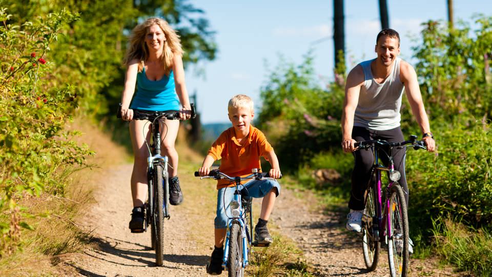
You can also visit the official website of the Rheinland-Pfalz Tourism Office to find out more about- Hiking
- Cycling
- Travel Highlights
- Event Highlights
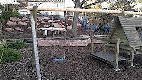
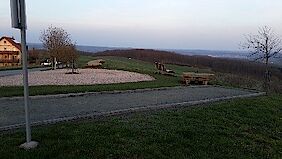
3 Playgrounds in Eulenbis
Spielplätze
Lindenstraße 5, 67685 Eulenbis
Hauptstraße 8, 67685 Eulenbis
Am Turm, 67685 Eulenbis
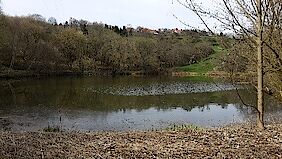
Artificial pond
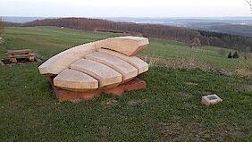
Artwork "life disc"
Lebensscheibe mit Ruhebank
Emmerwiesenhof
67685 Eulenbis
Big disc with a bench for relaxing – dressed sandstone by the artist Bauchle.
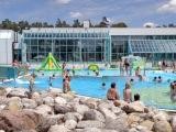
AZUR Water World in Ramstein
Freizeitbad AZUR Ramstein
Schernauer Strasse 50
66877 Ramstein-Miesenbach
Opening hours
Monday: 1 - 10 p.m.
Tuesday - Friday: 10 a.m. - 10 p.m.
Saturday: 10 a.m. - 8 p.m.
Sunday & Holiday: 9 a.m. - 8 p.m.
Short description
The AZUR Water World is a family-friendly indoor and outdoor pool providing year-round recreation for people of all ages.
The indoor area is equipped with a swimmer‘s pool of 25 meters length, a non-swimmer’s pool with massage jets and waterfall shower, a giant slide and a well-spaced area for kids including a water playground, Jacuzzi, steam bath, a sauna area offering scented steam treatments and a restaurant.
Outdoors you will find a large 50 meter long pool with diving platforms, a giant slide as well as a baby and kid's pool. The heated outdoor basin can be used in the winter time as well.
Belfry
Glockenturm
Eulenkopfstraße 21
67685 Eulenbis
The bell rings twice a day at 11 a.m. & 6 p.m.
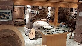
Berry Wine Museum
Beerenweinmuseum
Hauptstraße 8
67685 Eulenbis
Unique museum depicting the manufacturing of a typical pear wine from the western palatinate area.
Contact information
Arnold Jung
Phone: 06374 1310
Boules Area
Circular Hiking Trail
Course: Eulenbis – Erzenhausen
Short description
The 15 kilometer circular route leads through the villages of Erzenhausen and Eulenbis, with smaller inclines to be overcome. The Erzenhausen stalactite cave, the Beerewei(n)museum and the Eulenbis fruit tree nature trail as well as the wonderful view of the old Roman road are all worth seeing.
Key data
Distance: 15.3 km
Ascent: 356 m
Descent: 356 m
Cycle route "Lautertal"
Course: Kaiserslautern - Otterbach - Lauter valley - Lauterecken
Short description
This path runs 36km along the Lauter. Starting at Kaiserslautern Westbahnhof it runs through Otterbach, Katzweiler, Hirschhorn, Sulzbachtal, Olsbrücken via Wolfstein to Lauterecken. The Lautertal-Biking Path runs through the Lauter valley from Kaiserslautern till its ending in the Glan at Lauterecken. The 13 train stations along the way enable you to take a train when you do not want to bike anymore or bike one way and take the train back. Considering this luxury, this path is perfect for families and seniors.
Key data
Distance: 36,2 km
Ascent: 2 m
Descent: 82 m
Cycle route "Pfälzer Land"
Course: Enkenbach - Alsenborn - Otterberg - Weilerbach - Niederstaufenbach
Short description
The "Pfälzer Land" cycle path is with its 43 km the east-west connection from the Alsenz at Enkenbach-Alsenborn, through the North Palatinate highlands and thus leads directly through the union community Otterbach-Otterberg, to Niederstaufenbach.
The bike path leads through diverse, varied landscapes and offers good combination possibilities with other cycling tours.
Key data
Distance: 43 km
Ascent: 150 m
Descent: 195 m
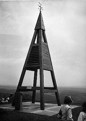
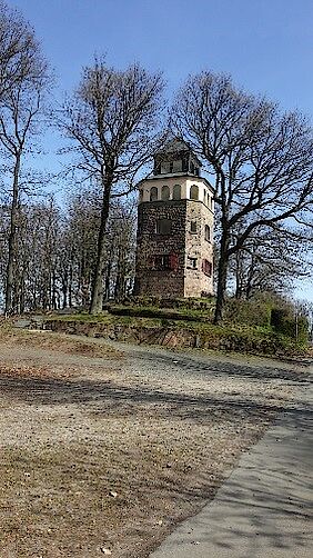
Eulenkopf Tower
Eulenkopfturm
Am Turm
67685 Eulenbis
Short description
Tower with a beautiful view over the area.
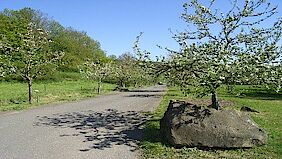
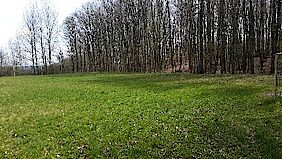
Fruit Tree Educational Trail
Obstbaumlehrpfad
Untere Pfeifermühle 7
67685 Eulenbis
Explore older varieties of apples and other fruits typical for the area.
Hiking Trail - Devil's Tour
Teufelstour
Start at train station in Olsbrücken
67737 Frankelbach
Route
Olsbrücken, Frankelbach, Eulenbis, Sulzbachtal
Opportunity to follow the trail in Eulenbis: GOOGLE MAPS
Key data
Distance: 14.9 km
Duration: 4:23 h
Ascent: 383 m
Descent: 382 m
Description
The slogan for the tour keeps its promise: devilish climbs and heavenly prospects. The 15 km premium trail "Teufelstour" takes its name from the Teufelstein, a former Roman quarry in Frankelbach. Geological highlights are explained on several information boards. A special feature: This path leads directly through the stone quarry of Sulzbachtal.
Supported by 1. FCK, (the local soccer club) the path was signposted using the devil’s emblem from the FCK’s stadium Betzenberg.
The mix of wild and romantic river valleys, steep climbs and a breathtaking view over the Palatine Uplands and the Palatinate Forest right up to the Donnersberg, makes the “devil’s tour” with its 15 km total length into a unique discovery tour of the Palatinate.
On narrow paths and trails which have hardly changed in the course of time we have the opportunity of passing through almost 300 million years of geological history. Passing both old and still active stone quarries, ambitious hikers can inform themselves on several geological information boards set up by the State Office for Geology and Mining.
For active recreation whilst hiking you should not forget to stop and take a break. Along the Teufelstour you will find many beautiful places to rest and linger. The Panorama-Gasthof Emmerwiesenhof in Eulenbis , for example, is situated directly on this premium hiking trail.
In "Fossils worldwide", Hebelstraße 4 in Sulzbachtal the geological subsoil can actually be felt. This exhibition is constructed as both a sales and museum vicinity. A wide range of minerals and fossils, which partly come from the immediate vicinity of the Sulzbachtal , are on display.
Contact information for a guided tour
Hiking leader of the union community Otterbach-Otterberg:
Mario Marx
Phone: 0157 36790509 or 06308 1358
Email: marimarx(at)web.de
Observation platform at Emmerwiesenhof
Aussichtplattform am Emmerwiesenhof
Emmerwiesenhof
67685 Eulenbis
Magnificent view with descriptions to the various points of interest in sight.
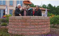
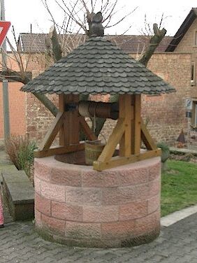
Old Wells in Eulenbis
Brunnen
Im Steineck 2, 67685 Eulenbis
Im Steineck 19, 67685 Eulenbis
Brunnenweg 6, 67685 Eulenbis
Schulstraße 4, 67685 Eulenbis
Hauptstraße 6, 67685 Eulenbis
Hauptstraße 8, 67685 Eulenbis
Outdoor swimming pool in Rodenbach
Waldfreibad Rodenbach
Sportstraße 6
67688 Rodenbach
Opening hours
May - September: Daily 10 a.m. - 8 p.m.
June, July, August: Daily 9 a.m. - 8 p.m.
Small football pitch
Swimming pool CUBO in Landstuhl
CUBO
Kaiserstraße 126
66849 Landstuhl
Opening hours
Mon. - Thu.: 10 a.m. - 10 p.m.
Fri. - Sat.: 10 a.m. - 11 p.m.
Sun. & Holidays: 10 a.m. - 8 p.m.