OtterbergRamstein Air Base · KMC


LEISURE TIME

Good to Know
Good to know
Regional activities
Looking for more events and recreational activities in the region?Ramstein and Kaiserslautern
Download the- CALENDAR OF EVENTS and
- LEISURE & SIGHTS brochure
Palatinate region
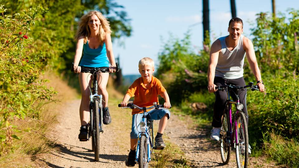
You can also visit the official website of the Rheinland-Pfalz Tourism Office to find out more about- Hiking
- Cycling
- Travel Highlights
- Event Highlights
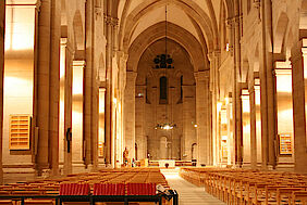
Abbey
Abteikirche
Gerberstr.
67697 Otterberg
Short description
The „Abteikirche“, built between 1168 and 1254 dominates the townscape of Otterberg. It’s tower-less façade, reaching a height of 26 metres, conveys a sense of awe to the beholder. The Abbey is the best-preserved Monastery in the Palatinate and with its internal length of 74 metres, also the second largest sacred building.
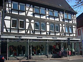
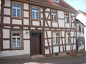
Binoth House
Haus Binoth
Hauptstr. 53
67697 Otterberg
Short description
Built in 1611 as a three-story house by Serva de Fay, it was then owned by the Raquet family after the 30-year war. In the first half of the 19th century it was the Inn "Zum Weißen Adler" and in 1841 it was in the possession of magistrate Karl Jung.
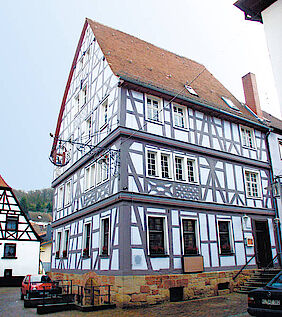
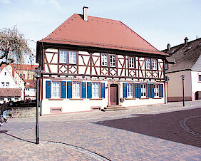
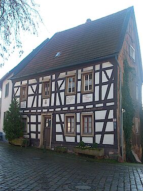
Blue House
Blaues Haus
Kirchstr. 1
67697 Otterberg
Short description
The „Blaues Haus“ was erected in 1612 on the foundation walls of the monastery’s Lay Brother’s quarters by Toussin Gille. In 1790 it became a Public House and brewery, which is illustrated by the hanging wrought iron six-pointed star sign. Between 1925 and 1927, the timber frame was re-exposed and due to the blue colouring of the infill panels at the time the building became known as the „Blaues Haus“.
Campsite
Campingplatz „Gänsedell“
In der Gänsedell 1
67697 Otterberg
Short description
The terraced complex is located on a wide forest path in a quiet, sunny south-facing slope and is only a few meters from the beautiful Otterberg.
Terrace area with 3.2 ha
140 parking spaces
15 toilets
1 laundry room
2 wash cabins
10 showers
1 sanitary building
3 sinks
Children's playground
ping pong
washing machine and dryerContact information
Phone: 06301 5537
Email: info@camping-otterberg.de
Chapter House
Kapitelsaal
Klosterstr. 17
67697 Otterberg
Short description
The chapter house is the only preserved room of the former monastery, next to the abbey church. The hall was not uncovered until 1925.

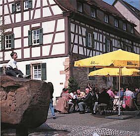
Church Square
Kirchplatz
Kirchstr.
67697 Otterberg
Short description
Today, the church square is the central point in the historic district and is dominated by the solid sandstone frieze of the fountain upon which the two most important events in Otterberg’s history are sculpted. To the north of the square lies the former rural estate house built by Mayor Jakob Seitz in 1778, which since the beginning of the 19th Century has been the restaurant „Zur Krone".
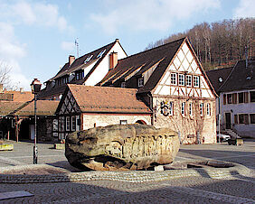
City Fountain
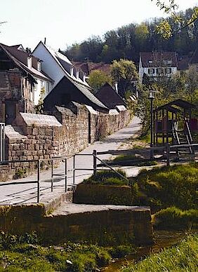
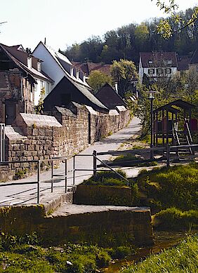
City Wall
Stadtmauer
Lauerstr.
67697 Otterberg
Short description
60% of the city wall is still preserved around the old town of Otterberg. It has been used as a retaining wall in houses or as a load-bearing wall in road construction. You can find larger and smaller fragments in the entire old town area,
Cycle route
Course: Enkenbach - Alsenborn - Otterberg - Weilerbach - Niederstaufenbach
Short description
The "Pfälzer Land" cycle path is with its 43 km the east-west connection from the Alsenz at Enkenbach-Alsenborn, through the North Palatinate highlands and thus leads directly through the union community Otterbach-Otterberg, to Niederstaufenbach.
The bike path leads through diverse, varied landscapes and offers good combination possibilities with other cycling tours.
Key data
Distance: 43 km
Ascent: 150 m
Descent: 195 m
Engel Mill
Engelsche Mühle
Lauerstr. 16
67697 Otterberg
Short description
Next to the oldest house in Otterberg, the residential building of the miller family Engel has been standing since 1663.
Ferkel House
Ferkelsches Haus
Hauptstr. 57
67697 Otterberg
Short description
Built in 1606, the house was partially destroyed during the Thirty Years' War. The building later served in the second half of the 19th century as a post office and shop.
Fountain
French reformist rectory and schoolhouse
Französich-reformiertes Pfarr- und schulhaus
Mühlstr. 13
67697 Otterberg
Short description
This building, erected in 1720 by the largest parish in Otterberg at the time, housed two schoolrooms and the residences of the vicar and teacher until the 1970’s. The front façade of this half-timbered building was built on the original foundations of the one of the monastery outbuildings.
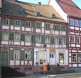
Galecki House
Guesthouse Krone
Gasthaus Krone
Hauptstr. 68
67697 Otterberg
Short description
Gasthaus Krone was built in 1778 by council mayor Jakob Seitz. It was originally an agricultural estate and was an exceptional building in the cityscape of Otterberg. In the beginning of the 19th century it became the restaurant "Zur Krone" and remained ever since. From 1895 to 1948 it was owned by the Johannes Gimbel family.
Guided tour through the old smithy
Schmiede Theis
Kirchstr. 15
67697 Otterberg
Time
The old smithy is open to the public at 4 p.m. every first Saturday of the month. Admission is free
Short description
Originally built in 1612 outside the walls of the monastery, this estate has been in the possession of the Theis family for seven generations and was in use as a forge until as recently as 1980. The forge is one of the oldest in the region and has been fully restored as a farrier museum complete with a pair of leather bellows and a solid sandstone forge.
Contact information
Hiking route - 1. Kneipp
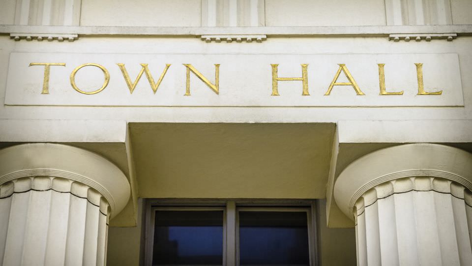
Starting point
City Hall
67697 Otterberg
Key data
Marking: Black 1 on a white disc
Distance: 9.5 Km (~ 6 miles)
Walking time: approx. 2.5 hours
Difference in altitude: 50 meter (~ 55 yards)
Option for a stop: Restaurants in Otterberg”
Description
From the starting point close to the town hall, which was officially opened in 1990, follow the route along “Lauterer Straße”. The local people call this road “Lautringer Weg”. In the past when people were still going to their workplaces or to the market on foot it was the connecting road to K’town. We follow this route until just before the “Beutlermühle” (Beutler-Mill) where we turn left into “Baumstrasse”. In the past the “Beutlermühle” was known as a deserted settlement by the name “Weiler”. For the first time “Weiler” is mentioned in the foundation document of the Otterberg Monastery from the year 1143, in which the Abbot of Eberbach inter alia “received the benefice of the next located small village”.
After dissolution of the Otterberg Monastery in 1566, the Palatine administrator Engel leased “Weiler” out for 6 years. In 1579 “Hofhaus Weyler” and adjacent buildings were handed to the newly settled Walloon citizens for free. The official Otterberg inventory of 1658 lists for “Capelle zu weyler” the following: 1 chapel, 3 houses, 4 meadows, 1 yard, 1 mill (“Walkmühle”), and some property (“Woog”) in the “Weyler Grund”.
The “Walkmühle” was destroyed during the Thirty Years’ War. After 1707 the Mennonite Christian Beutler purchased and rebuilt the place, which was at that time named the “Alte Walckmühl zu Weyler” including the only old house left close to the street. For a long time the family owned the site and it had been used as a farm and mill until quite recently.
Follow the route to the “Rotenberg” (305 m), named after all the red sand around it. Thereafter you walk downhill the “Götzenwooger Hang” to the valley of “Raupenthal”. Here you find a boundary stone from 1786. This area is named “Götzen-“ or “Kätzenwoog”, which had been the fishing grounds for the monastery. It does not exist any more but is still a very wet area. We continue through a very long and flat plain, Black Forest in the vernacular, until we arrive at “Ultes-Rast”, a recreation area, which invites for a rest. After that we turn left and walk about 800 m uphill to “Weinbrunnerhof”, which is named after a so-called “wine well” in the vicinity. There are different opinions about the origin of this name. Some say that it got the name because it was located close to a wine trail, on which the wine grower transported their wines. Others say that the well is named after the Middle High German word “winne”, which stands for cattle pasture. The “Weinbrunnerhof” was originally a factory for glassworks, which was founded in 1709. Presumably it was closed during the second half of the 18th century due to a decreasing stock of wood. After that until today the “Weinbrunnerhof” has been used for agricultural purposes.
“Haus Hamann”, located at the forest edge of “Weinbrunnerhof”, is a nice hotel and restaurant (closed on Monday). We continue our hike into direction “Althütterhof”. At the fork in the road, opposite the house of Family Stark, you’ll find a very old fruit press. The marking continues along the main road whereas a wonderful trail goes into the same direction on the other side along the edge of the forest. We follow the markings or trail along the “Weinbrunner Valley” until we reach “Althütterhof”.
The name had been derived from an old factory for glassworks, which was located there once. In a report from the 22nd February 1661 it was mentioned for the first time. The Electoral government leased 300 acres beech wood to Mrs von Conde with the obligation to build a factory for glassworks and to pay a rent of 60 guilders per year. This little factory produced beer and wineglasses, goblets and windowpanes without being very successful. During construction works in 1966 workers found leftovers of foundations and glass production tools as proof of this facility. In 1788 this factory ceased to exist, because in a book from this year this place was mentioned now as a farm called “Meierhof”.
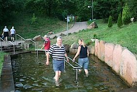
When we continue we see some ponds on the left, which were used for fish farming already during the time of the monastery. When monastery ceased to exist most of the ponds were drained and became meadows. However, you can still see some ponds to the left of the road. At the tennis court of “OTC Mühlwoog” turn left into the “Bachstade” and follow the footpath along the “Mühlenbach”, a man-made stream leading up to the city wall of Otterberg. After just some meters you pass the Kneipp-Facility “im Dreibrunnen”, where you can refresh arms and legs with some cold water. Finally, walk along the idyllic “Bachstade” back to the town hall.
Hiking route - 2. Pavillion
Starting point
Johannis parking lot
67697 Otterberg
Key data
Marking: Black 2 on a white disc
Distance: 5 km (~3.1 miles)
Walking time: approx. 2 hours
Difference in altitude: 300 m (~328 yds)
Option for a stop: Hotel “Badstube”
Description
Warning: Circular Route No 2 involves some extremely steep walks.
We start from the parking lot in Johannisstraße in the town centre of Otterberg. This square used to be the “Stadtweiher (town pond) and served as a retention basin in front of the town wall. Until the end of the twenties of the last century the pond was used for bathing. The pond was backfilled in 1967 and a parking lot was built. We proceed along the Otterbach brook through the pond gardens, which is a greenbelt recreation area near the town. After a couple of hundred metres we see the oil mill (Ölmühle), a former agricultural building with a facility that was used to process oleiferous fruit. Count palatine Johann Casimir authorized the mill to operate as early as 1581. The premises are located at the foot of castle hill (324 metres) (Schlossberg), which has its name from the Otterburg castle that used to be on that hill. In 1143 Siegfried IV von Boyneburg-Nordheim donated the castle to the Cistercian monastery Eberbach in the Rheingau valley (near Wiesbaden). From 1168 to 1254 the abbey church and major parts of the monastery were erected in the Ottertal valley. Apart from the abbey church and chapter house, only some fragments can be found in town today.
A model of the monastery is on exhibition in the museum of local history, which illustrates the dimensions of the original property.
We cross the country road L387 and pass “Hotel Badstube”. In the open space to the right of the valley along the rivulet some horses, geese and ducks are kept. After 200 m (~220 yds) the road leads into the forest where you’ll find a summerhouse on the left side. Follow the marking for route No. 2 and turn left at the fork after about 250 m (~270 yds).
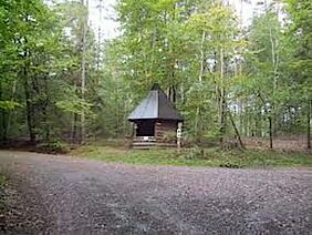
After a long ascent of 1200 m (~1312 yds) we arrive at the “Pavillon”. The “Pavillon” is a hut, which was built by members of Pfälzerwald Association’s local group Otterberg. Here you can take a little rest. If you follow the path approx. 1000 m (~1093 yds) straight ahead you will arrive at a prehistoric menhir, which dates from primitive times.
We turn left and follow the broad path downhill. After about 100 m (~110 yds) you can either turn right onto an unmarked path, which leads to the recreation and parking area “Grafenthalerhof”, or you stay on the broad path and get to the “Heiligenmoscheler Berg” hill after 1200 m (~1312 yds).
Here we hit a fork where we turn left and follow the path for about 300 m (~328 yds). At the barrier you can either make a right turn and follow the path to an open-air forest classroom or follow the marking for route No. 2 and approach a training ground for traffic newcomers. Here young (and old) cyclists and motorists with and without driver’s license can practise their driving skills in simulated road traffic. This is the only place in the whole county to do so.
We follow the path through a forest of sweet chestnut trees and arrive at a war memorial. From here you have a unique panoramic view over Otterberg. Finally, steep stairs and a small path between houses will get you back to the starting point of Kneipp Circular Route No 2.
Hiking route - 3. Wallonen
Starting point
Johannis parking lot
67697 Otterberg
Key data
Marking: Black 3 on a white disc
Distance: 12 km (~7.5 miles)
Walking time: approx. 4 hours
Difference in altitude: 50 meters (~55 yds)
Option for a stop: Restaurant “Wallonenhof”
Description
Kneipp Circular Route No 3 takes you through mixed forest on comfortable roads and paths without any major steep walks.
We start from the parking lot in Johannisstraße in the town centre of Otterberg. This square used to be the “Stadtweiher (town pond) and served as a retention basin in front of the town wall. Until the end of the twenties of the last century the pond was used for bathing. The pond was backfilled in 1967 and a parking lot was built.
We proceed along the Otterbach brook through the pond gardens, which is a greenbelt recreation area near the town. After a couple of hundred metres we see the oil mill (Ölmühle), a former agricultural building with a facility that was used to process oleiferous fruit. Count palatine Johann Casimir authorized the mill to operate as early as 1581. The premises are located at the foot of castle hill (324 metres) (Schlossberg), which has its name from the Otterburg castle that used to be on that hill. To the right we see “Schwarzhübel” hill (342 m - ~374 yds). After 400 m (~437 yds) we reach the sports centre and walk around the swimming pool, which is filled with unchlorinated pure spring water. We proceed along the path between the swimming pool (left) and the restaurant (right) along the “Neumühler Hang” slope through the “Scheid-Wald” forest. This path is also called the “Totenweg” (path of the dead) because all deceased people from the Drehenthaler Hof farm were carried along this path for their funeral at the graveyard. After 2 km (~1.3 miles) at the Drehenthaler Hof farm we cross the road and walk straight ahead onto the forest way.
The route is now marked with the well-known “3” and additionally, with a red dash, a symbol for the international long-distance hiking trail leading from the Donnersberg hill via the Pfalz to French Alsace. After 400 m (~437 yds) we turn right towards Potzbach. 500 m (~547 yds) further down the road, close to marking No 7, we find the so-called “Hünen- or Hügelgräber” (hill graves). These are prehistoric burial mounds. Unfortunately, archaeological excavations are not allowed that might hint at the source, age, or scientific background of these stones formations.
We continue our walk for about 1.8 km (~1.2 miles) until the paths with markings “3” and “red dash” separate again. We turn right and follow the “3” to the western offshoots of the “Einsiedler Berg” hill (370 m / ~404 yds). We pass a picnic area with an oval group of seats, which are dedicated to Oswald Schäffler, a local celebrity. 2.5 km (~1.55 miles) further on we arrive at the “Rabenthal” road, which is part of the “Drehenthaler Hof” farm. The premises are located on the grounds of former glass works dating back to the early 18th century and that ceased to exist in the middle of the 19th century. Today, about 400 people live in the area which is predominatly used as farmland. From a fountain structure in the centre of the village we continue along a road called “Glashütter Straße”. After 750 m (~820 yds) a small road to the left leads to a very popular barbecue area.
Behind the cemetery, we follow the path just beside the main road, which we used earlier. The marking “3” guides us to the elevated hiking trail via the “Schweisberg” hill (334 m, ~365 yds). After 250 m (~237 yds) on the other side of the main road in the “Fuchsbrunner Wald” forest a fairground is located, where the people of Otterberg celebrate their traditional spring festival every two years (in odd years only). After another 250 m a stone quarry is located to the left. The building blocks for the memorial on the “Heiligenmoscheler Berg” hill were taken from here in 1933. It is one of five stone quarries, which are still operated around Otterberg.
The adjacent flood plain is the source of water supply for the area (pumping station) and the source of the Otterbach brook, which actually comes from the “Otter spring” at the “Scheidwald” hill (363 m, ~397 yds).
We can also see the “Neumühle” residential building, which was a flour mill in former times. Until 1960 the “Lohmühle” mill was located slightly above; the works produced tanning agents for the numerous tanneries in Otterberg.
After walking past the pump station we walk through the “Otter” valley. This idyllic path lined with very old trees, takes us back to the starting point in Otterberg via the swimming pool.
Hiking route - 4. Appental
Starting point
City Hall
67697 Otterberg
Key data
Marking: Black 4 on a white disc
Distance: 11 km (~6.8 miles)
Walking time: approx. 4 hours
Difference in altitude: 100 meters (~110 yds)
Description
Kneipp Circular Route No 4 is an easy walk without any major slopes. There might be some wet spots just after the start of the walk.
From the starting point close to the town hall, which was officially opened in 1990, follow the route along “Lauterer Straße”. The local people call this road “Lautringer Weg”. In the past when people were still going to their workplaces or to the market on foot it was the connecting road to K’town. We follow this route until just before the “Beutlermühle” (Beutler-Mill) where we turn left into “Baumstrasse”. In the past the “Beutlermühle” was known as a deserted settlement by the name “Weiler”. For the first time “Weiler” is mentioned in the foundation document of the Otterberg Monastery from the year 1143, in which the Abbot of Eberbach inter alia “received the benefice of the next located small village”. A document from 1195 certifies that “Wilre” alias “Weiler” is owned by the monastery and, later on, Pope Innozenz III. confirmed the title in 1215. The privilege to do timber work by the monastery and the farmyards “Schwanden” and “Weiler” in the forests of “Waltmark and Brant” was granted in 1275 and again documented in 1324.
After the Otterberg monastery was disbanded, the Palatine administrator Engel leased “Weiler” in 1566 for 6 years. In 1579 “Hofhaus Weyler” and the adjacent buildings were handed to the newly settled Walloon citizens for free. The official Otterberg inventory of 1658 lists for “Capelle zu Weyler” the following: 1 chapel, 3 houses, 4 meadows, 1 yard, 1 mill (“Walkmühle”), and some property (“Woog”) in the “Weyler Grund”.
The “Walkmühle” mill was destroyed during the Thirty Years’ War. After 1707 the Mennonite Christian Beutler purchased and rebuilt the place, which was at that time named “the Alte Walckmühl zu Weyler” including the only old house left close to the street. For a long time the family owned the site and it had been used as a farm and mill until quite recently.
Follow the route to the “Rotenberg” hill (305 m, ~334 yds), named after all the red sand around it. In the beginning the path might be very soaked and not easy to walk along. At the intersection point after about 1 km (~0.62 miles) we walk straight ahead following the marking sign “No 4” only. To the right we see a path marked “No 1 and 4”, which will be our way back; to the left we have the route to “Althütterhof” which is marked with a blue and yellow dash.
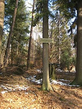
After 100 m (~109 yds) a landmark on the left side shows an abbey crook with the date 1786. After another 500 m (~546 yds) we reach an elevation of 301 m (~330 yds) on top of the “Pfifferlingsberg” or chanterelle hill. More landmarks with the above signs follow after 150 m (~160 yds) each.
At the next road junction after approx. 1 km (~0.62 miles) turn right and follow the marking “No 1, 4, and red dash”. After 200 m (~218 yds) you come to “Ultes Rast”, a rest area consisting of two tables and four benches named after a former lumberjack.
Thereafter, turn left and follow the route marked “No 4”. The path will make a slight right turn and proceed downhill after about 200 m (~218 yds) and has a sandy and soft surface now. Along the path there is another landmark and after a light slope of approx. 500 m (~546 yds) we’ll find a bench for a little rest.
Follow the route, which will turn right after 200 m (~218 yds). Stay on this track with a solid surface to the “Hundskopf” hill (361 m, ~395 yds), where you see the water reservoir for the community of Erlenbach.
After another 100 m (~109 yds) we pass the so-called “Franzens Bank” bench, another rest area, and walk downhill into the “Raupenthal” (valley of caterpillars). There is another landmark next to the path. The next 400 m (~436 yds) you walk over soft forest soil, followed by a 300 m (~328 yds) sloping downward on a loose gravel path. There are some anthills at the wayside. Shortly after that, at the “Götzenwooger Hang” slope, route 4 and 1 come together once more. Now the path is leads uphill to the “Rotenberg” hill again, where we hit fork. Here another bench invites you for a rest.
From here follow the well-known route “No 1 and 4” back to the starting point in Otterberg via the “Rotenberg” hill.